
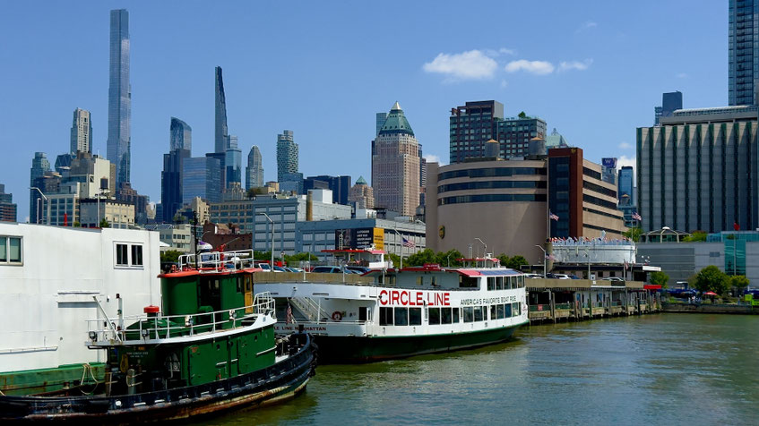
Our first week in New York last July, and there we were, lined up with the riffraff for one of the most unapologetically touristy things you can do in the city—a full circumnavigation of Manhattan aboard the Circle Line Sightseeing Cruises. We did it without hesitation. In fact, doing Obvious Tourist Things has become one of our favorite ways to get our bearings in a new place.
That philosophy didn’t arise overnight. After the pandemic, when travel felt new again, we started deliberately trying the things locals roll their eyes at—harbor tours, observation decks, the sort of activities usually hyped with laminated signs and a cheerful font like Comic Sans (but not Papyrus…never Papyrus). Back home in Seattle, a few of those experiments turned out to be unexpectedly useful.
You see a place differently from the water, or from above, or from the seat of a slow-moving bus. The geography snaps into focus. Neighborhoods stop floating around in your head like disconnected names and begin arranging themselves into something coherent.
So when we arrived in New York and spotted the Circle Line schedule, we didn’t hesitate. If you’re going to understand Manhattan, it helps to start with the fact that it’s an island.
The boats themselves look like they’ve been doing this job since the Eisenhower administration—and they have. Circle Line started running harbor cruises in 1945, when New York Harbor was still a working waterfront, with freighters, tugboats, cargo docks, ocean liners, the whole maritime apparatus that powered the city. The ships have been updated and repainted many times since then, but the design still feels unmistakably mid-century—wide decks, generous windows, and the sort of sturdy functionality that suggests they were built to show people things rather than impress them.
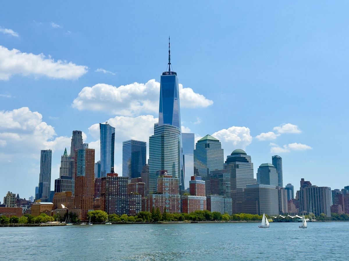
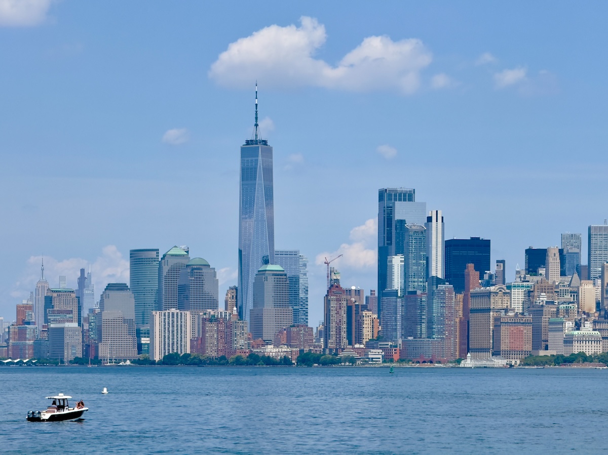
Ours pulled away from the pier in Hell’s Kitchen one sunny afternoon and eased south along the Hudson River, the skyline rising like a steel wall to our left. Manhattan from the water looks more orderly than it feels when you’re walking the streets, the buildings lined up in neat vertical ranks. The farther south we went, the more recognizable the silhouettes became—first Midtown’s jagged profile, then the dense cluster of towers that mark Lower Manhattan.
From the water, you begin noticing things that get lost when you’re standing on the sidewalk. The skyline no longer looks like a chaotic crowd of buildings. It’s layered. Older masonry towers sit beneath newer glass spires. Thin residential skyscrapers rise improbably high above neighborhoods that once topped out at a respectable 20 stories. The whole thing looks less like a collection of buildings and more like a geological formation.
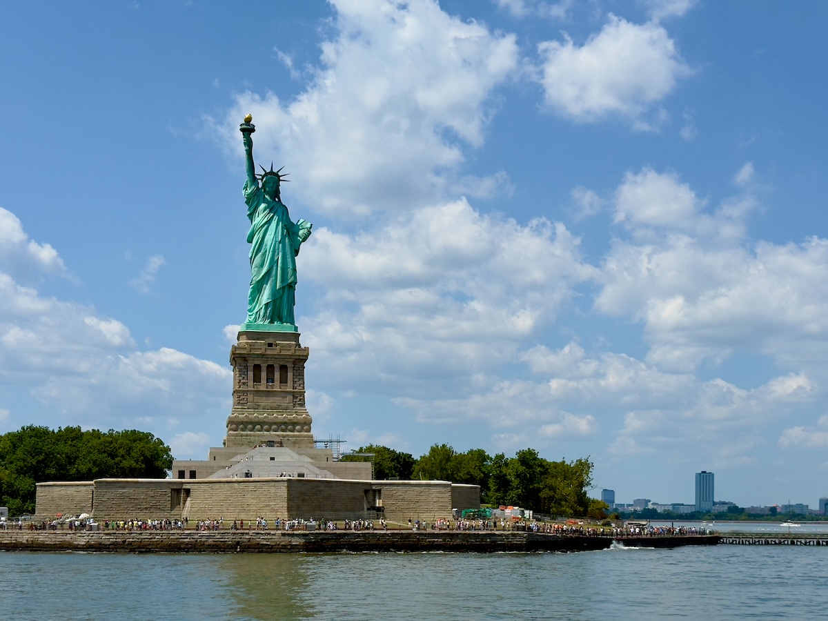
We rounded the southern tip of the island, passing Ellis Island—sadly wrapped in scaffolding—and swung out toward the harbor, where the Statue of Liberty held her torch off to one side, as she has since 1886. It’s an image so familiar it almost feels rehearsed, but seeing it from the water restores a little of its original meaning. For millions of immigrants arriving by ship, this was the first clear view of the city they were about to enter. Even today, the harbor carries a faint sense of arrival with it.
From the water, the Statue of Liberty is oddly smaller than you expect. Photographs make it feel enormous, towering over the harbor like some mythological guardian of the city. In reality, it's more modest in scale, standing calmly on its pedestal out in the water.
Even so, the statue is beautiful in a way that sneaks up on you once you’re out there on the water. Whatever arguments people manage to invent around it from time to time, the basic sentiment still lands the way it always has. A welcome. A promise. A reminder of what the place once aspired to be.
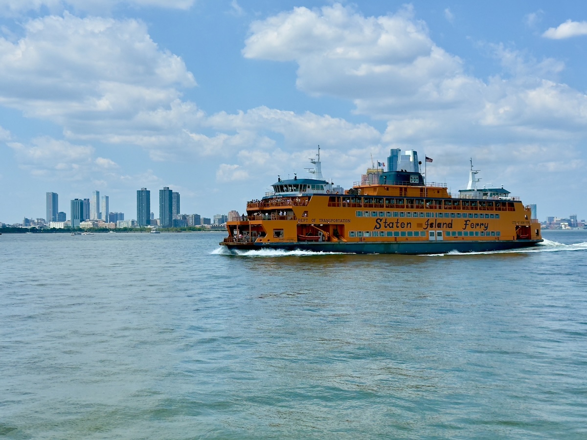
From there, the boat swung past the southern tip of Manhattan and turned north into the East River. Manhattan’s carefully staged façade began to slip. A bright orange Staten Island Ferry cut across the harbor in front of us, making its steady commute between Manhattan and Staten Island. It’s one of those New York institutions that tourists photograph but almost never ride.
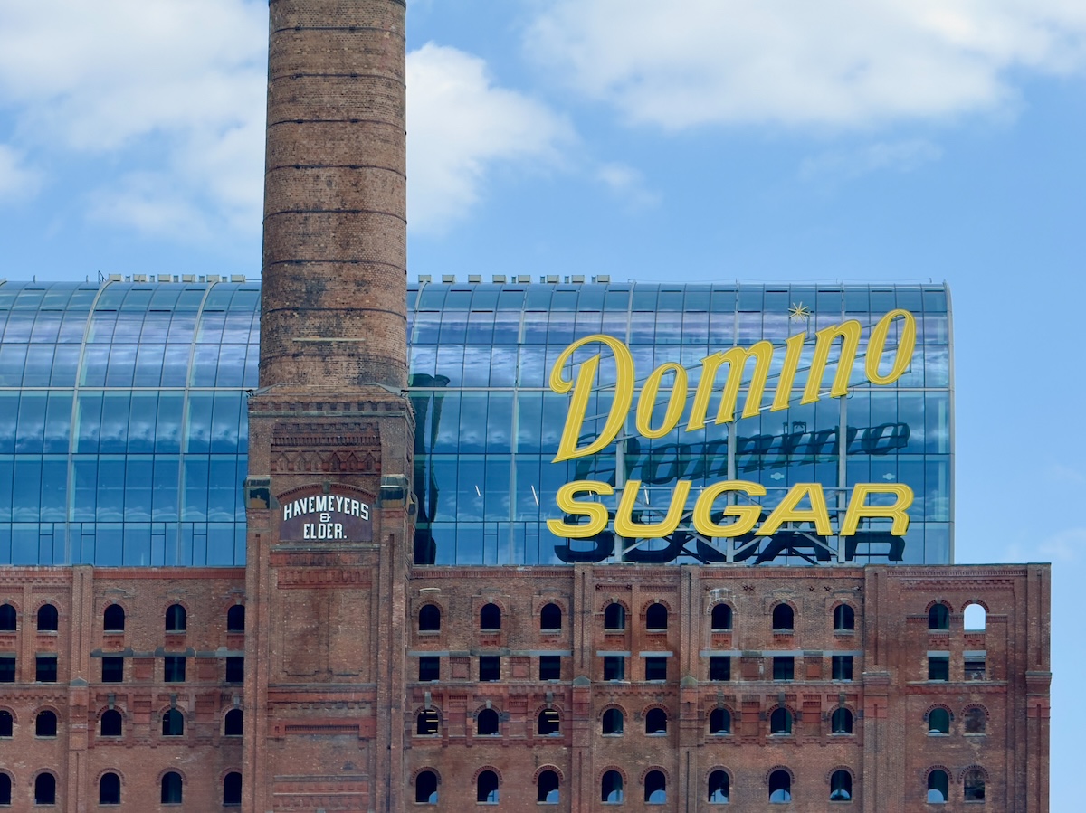
Brooklyn stretched out across the water, and Manhattan rose behind us instead of beside us. Industrial relics still appear along the shoreline if you know where to look. The Domino Sugar refinery in Williamsburg, its giant yellow sign still blazing above the brick factory buildings, once processed millions of pounds of sugar arriving from Caribbean ships.
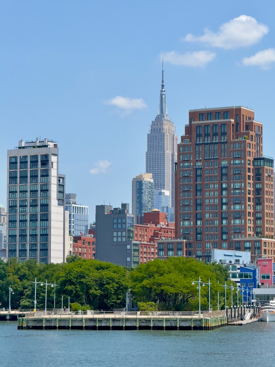
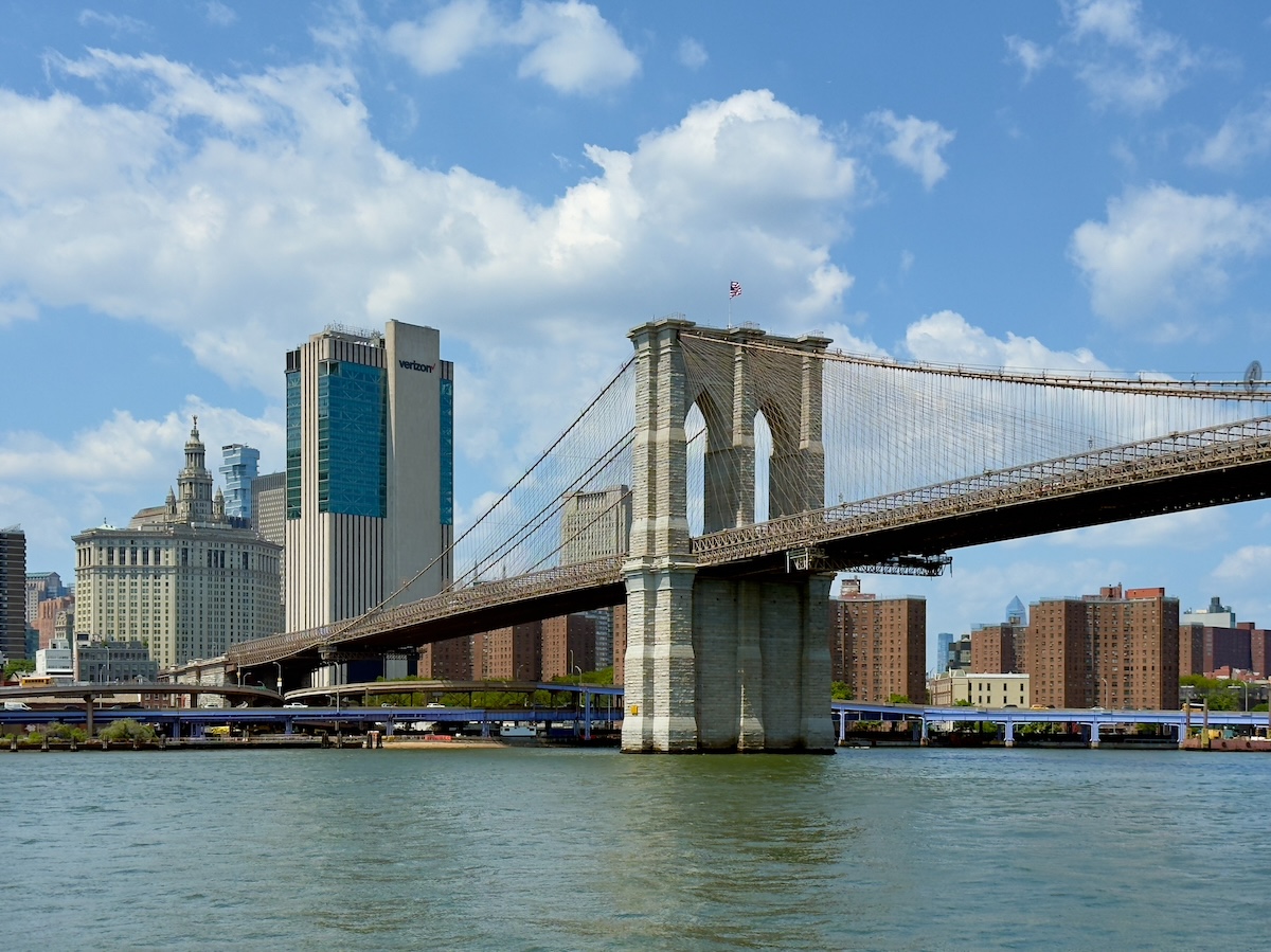
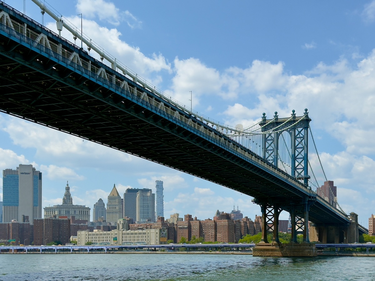
The skyline reversed itself. Bridges that feel massive from the street suddenly look delicate from the water. From directly underneath the Brooklyn Bridge, its web of cables and stone towers looks like lace against the deep blue sky. At one point, the Empire State Building lined up perfectly between two new residential towers along the riverbank, a brief architectural sight gag that lasted only as long as the boat stayed in the right position.
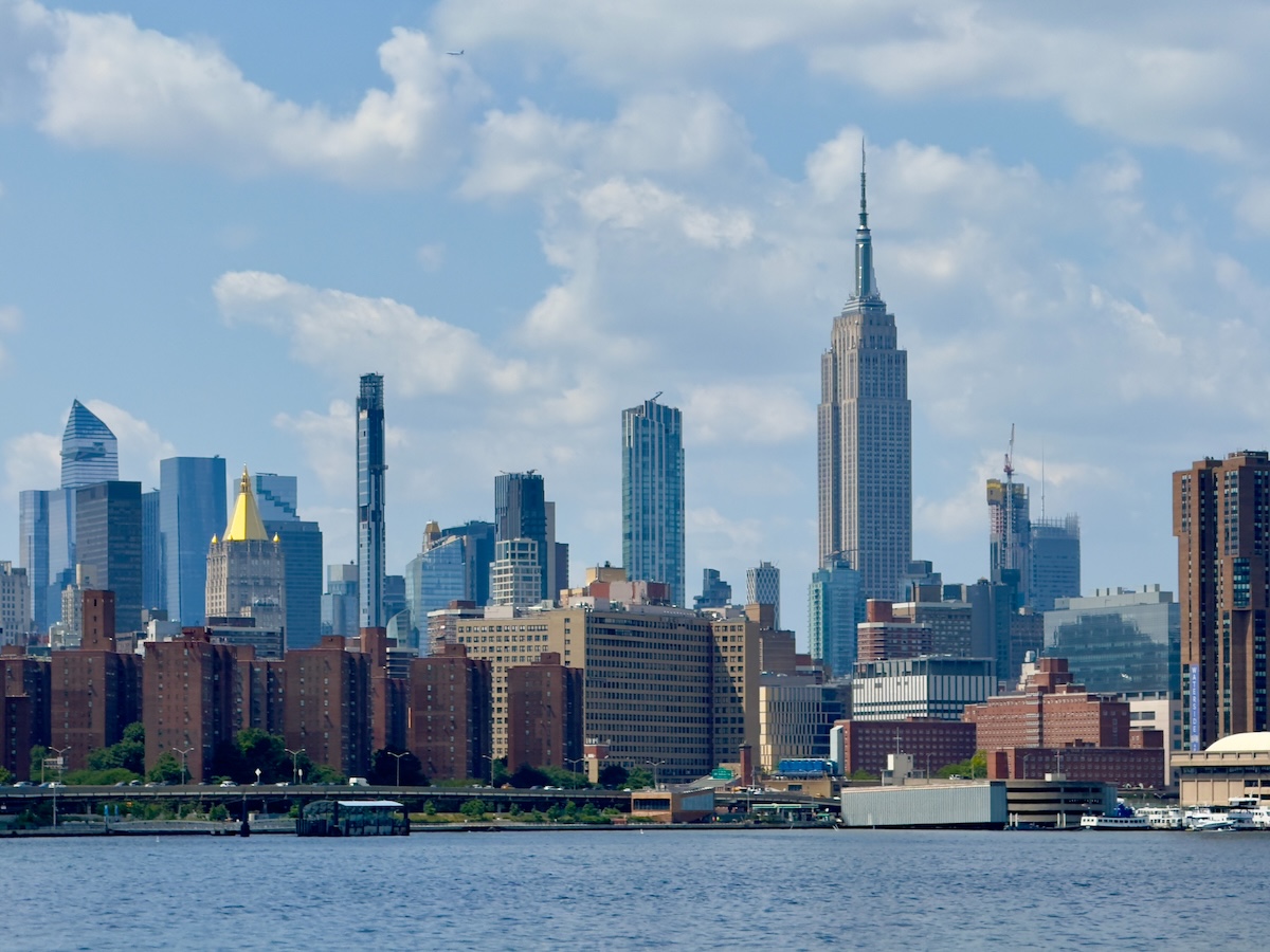
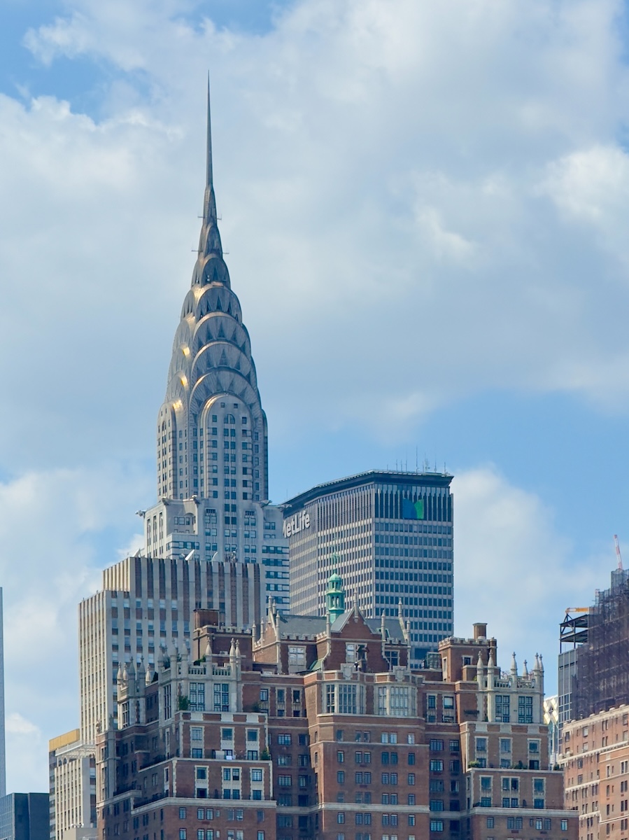
From this perspective, it becomes obvious that Midtown sits farther back than you expect. The Empire State Building rises above a long line of brick apartment blocks. The Chrysler Building appeared briefly between the towers, still the most elegant skyscraper in the city if you ask me, its stainless-steel crown catching the sun like a piece of jewelry.
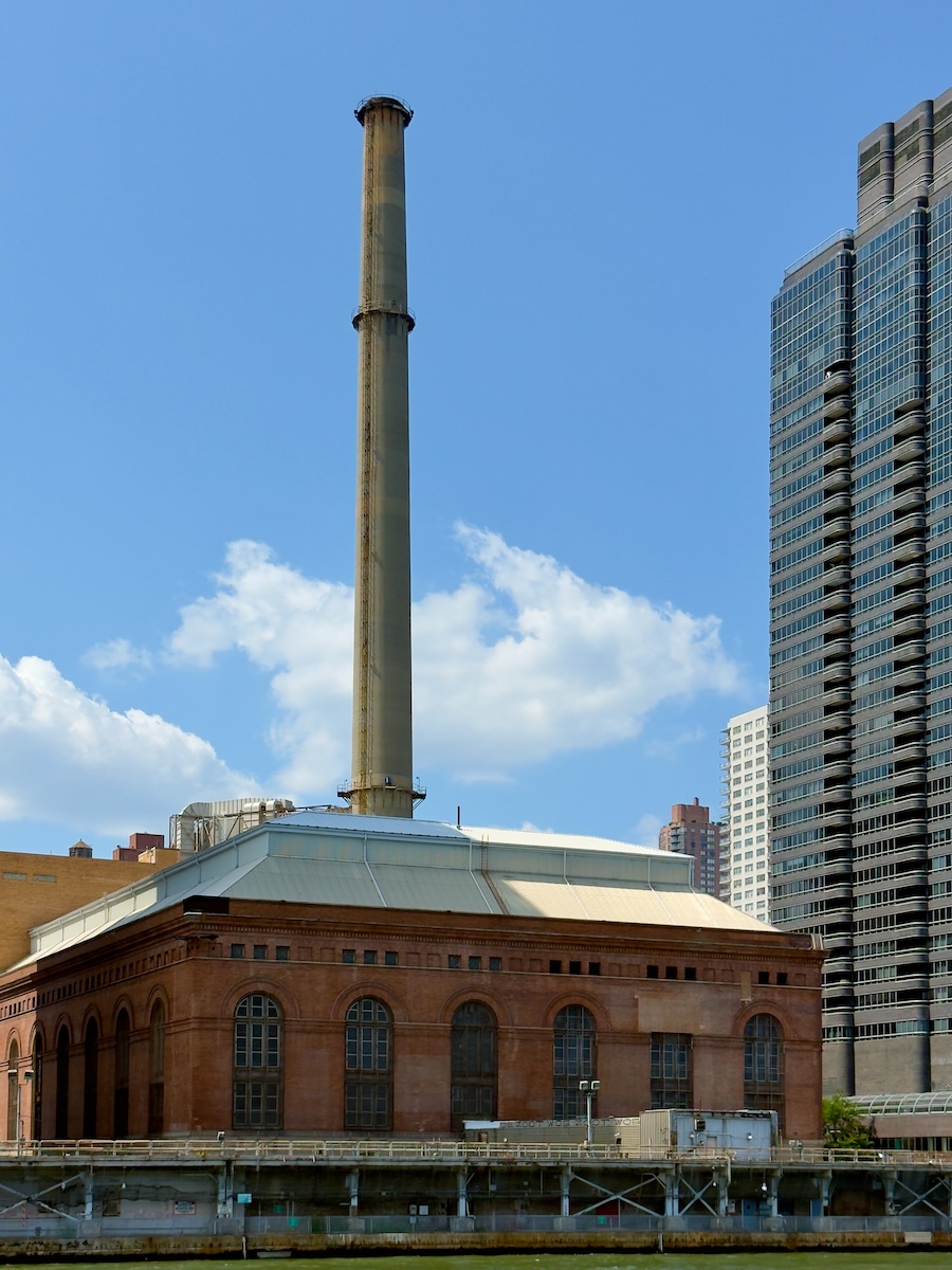
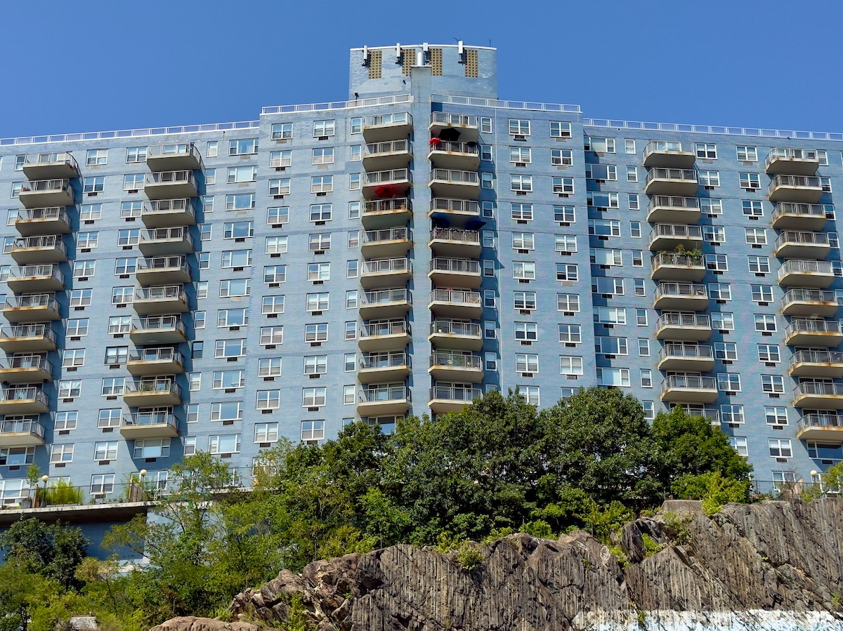
Farther north, the shoreline became a steady sequence of apartment towers, hospital complexes, and waterfront parks. The United Nations headquarters slid past on the Manhattan side, a green slab of international bureaucracy facing the river. Beyond that, the river widened. Old industrial buildings still show up—power plants, smokestacks, the occasional warehouse—reminders that the river was once a workplace rather than scenery. Across the river in Long Island City, the old Pepsi-Cola sign still stands over the waterfront, a neon relic from the era when factories lined the East River instead of luxury towers.
Somewhere along this stretch of river, your map of New York quietly rewires itself. Walking through Manhattan, you experience the city neighborhood by neighborhood—SoHo, the Village, Midtown, each one its own self-contained universe. From the water, the island reveals its physical shape. You see how long it really is, how the neighborhoods stretch out along the edges, and how the famous skyline is only a small section of a much larger island.
Eventually, the boat slipped into the Harlem River, which sounds impressive until you learn it’s not actually a river. It’s a narrow tidal channel connecting the Hudson and the East River, which means the current reverses direction with the tides—something that feels almost on brand for New York. The Hudson is actually a tidal estuary, and the East River is a strait, so Manhattan’s famous “three rivers” are really just different flavors of ocean water surrounding the island.
The surrounding scenery changes character again this far north—though it’s technically only halfway up the island. This is the point where Manhattan stops posing for photographs and starts showing its lived-in side—rail lines, highway ramps, and the sort of industrial infrastructure that helps the city function.
Across the narrow channel, the Bronx finally came into view, which feels momentous if only because it's the one borough in New York actually on the mainland. That’s right—Queens and Brooklyn are on an island, too—the southern end of Long Island. The name comes from Jonas Bronck, a 17th-century settler whose farm once stood along this stretch of river. Early New Yorkers spoke of traveling "to the Bronck's," which gradually hardened into the Bronx. It's one of the few places in English that insist on keeping the definite article. Nobody lives in Bronx. You live in the Bronx, whether you like it or not.
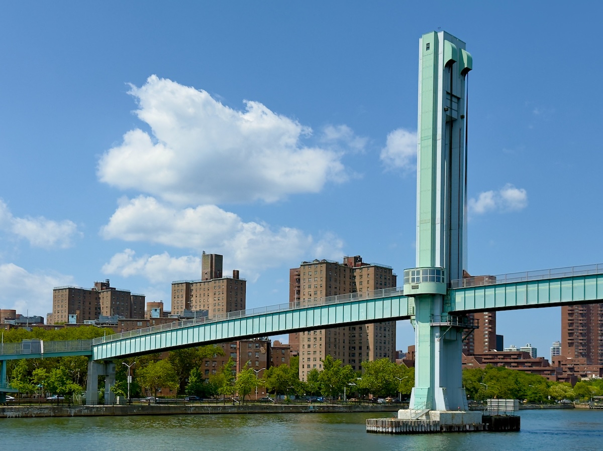
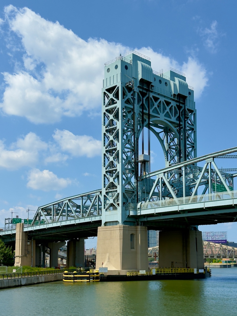
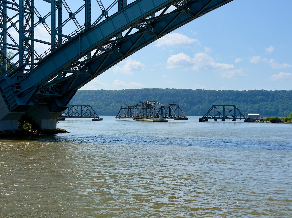
The borough looks less like a single place than a landscape of bridges and infrastructure. The Harlem River is crossed so many times in such a short distance that the skyline begins to resemble an engineering diagram—swing bridges, lift bridges, highway spans, and rail lines stacked almost one after another. Somewhere behind them sits Yankee Stadium, though from the river it mostly announces itself by suggestion rather than spectacle.
Geography gets a little strange here as well. In the 1890s, engineers cut a shipping canal through the northern tip of Manhattan to improve navigation, accidentally isolating a small neighborhood called Marble Hill. On paper, it's still part of Manhattan. On the ground, it's attached to the Bronx, which feels perfectly appropriate in a corner of New York where even the rivers aren't what they claim to be.
As we turned to go around the northernmost tip of Manhattan, our boat slowed and drifted to a stop while a railroad bridge ahead of us rotated open. Not lifted—rotated. The Spuyten Duyvil Bridge slowly pivoted to the side to clear a path for the boat, exactly as it has for 125 years. Watching a piece of Victorian engineering calmly go about its work in the middle of modern New York was oddly satisfying. And for one minute, the city looked less like a futuristic skyline and more like the industrial port it once was.
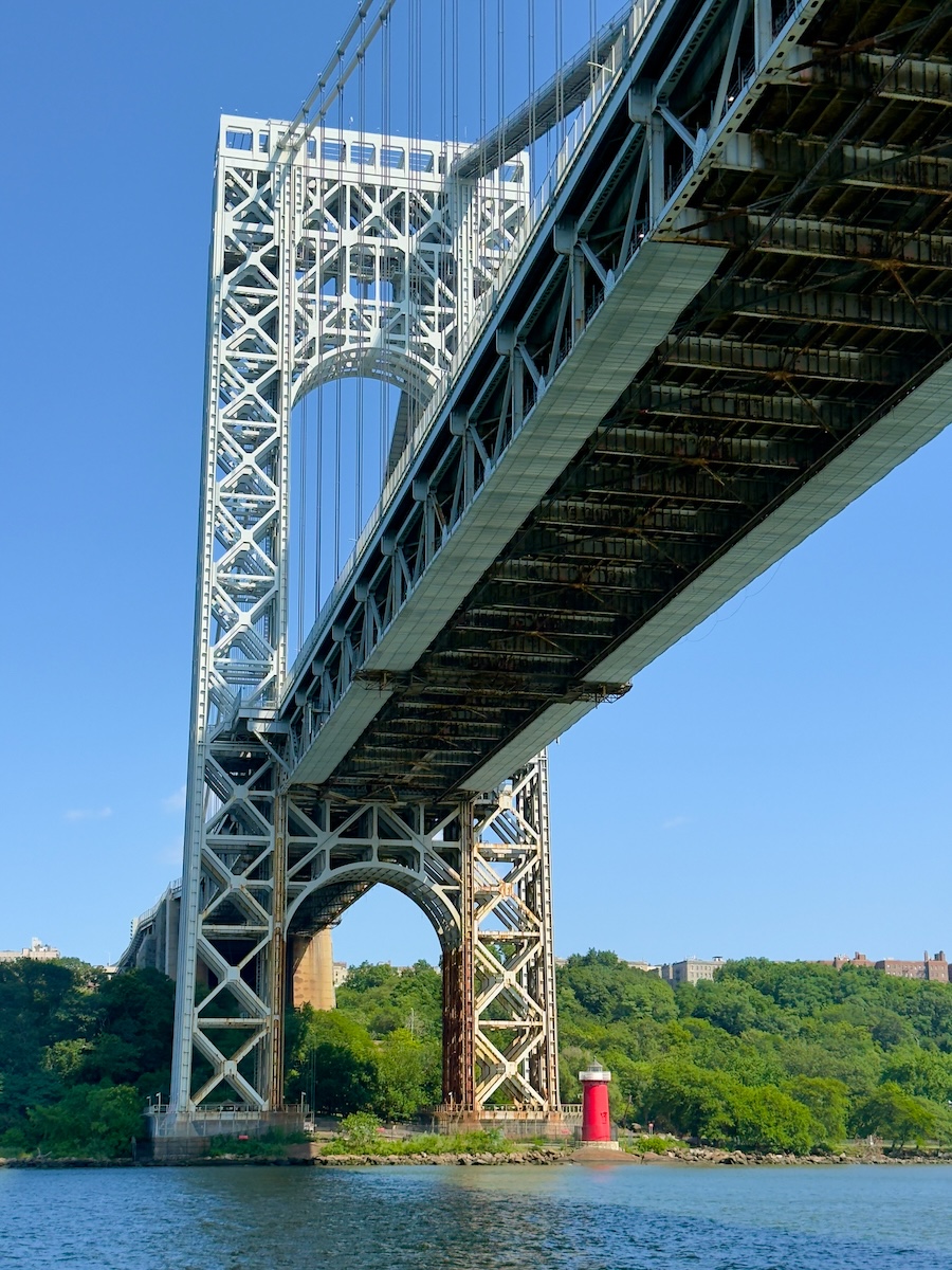
After rounding the end of Manhattan, we emerged back into the Hudson River, where the island revealed one of its most charming visual jokes. Looming overhead was the massive George Washington Bridge, a steel structure spanning the river like an industrial cathedral. Tucked beneath it, comically small, sat a Little Red Lighthouse. The bridge carries eight lanes of traffic between Manhattan and New Jersey. The lighthouse could comfortably fit inside one of its steel arches.
The lighthouse dates to 1880 and once guided ships along the river before the bridge arrived, making it utterly obsolete. When officials proposed removing it, though, public outcry—sparked largely by the beloved children’s book The Little Red Lighthouse and the Great Gray Bridge—saved the little structure from demolition. Today it remains in place, dwarfed by the bridge above it, a tiny red reminder that New York’s layers rarely erase one another completely.
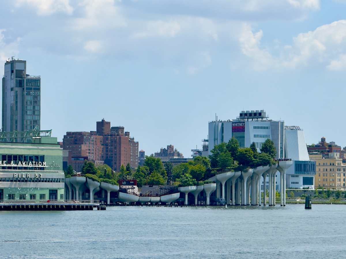
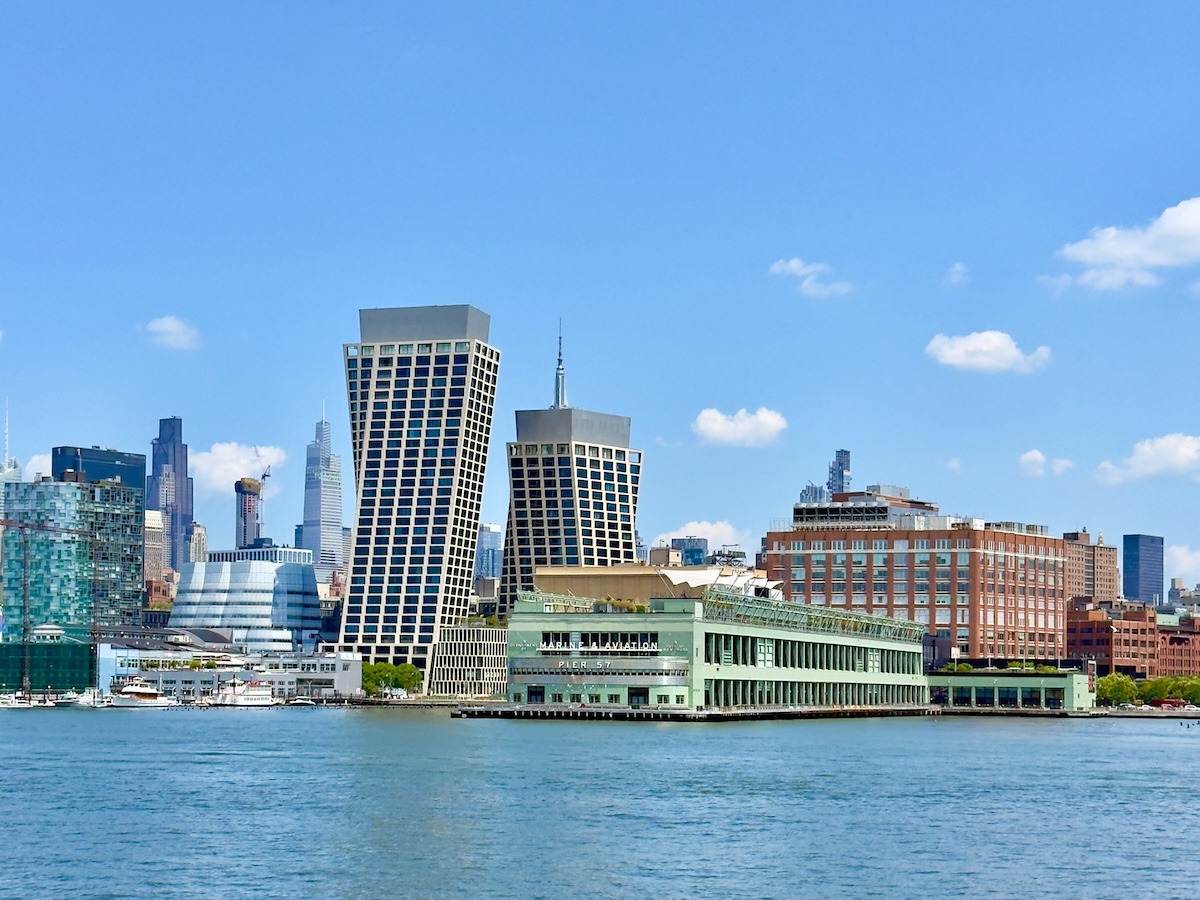
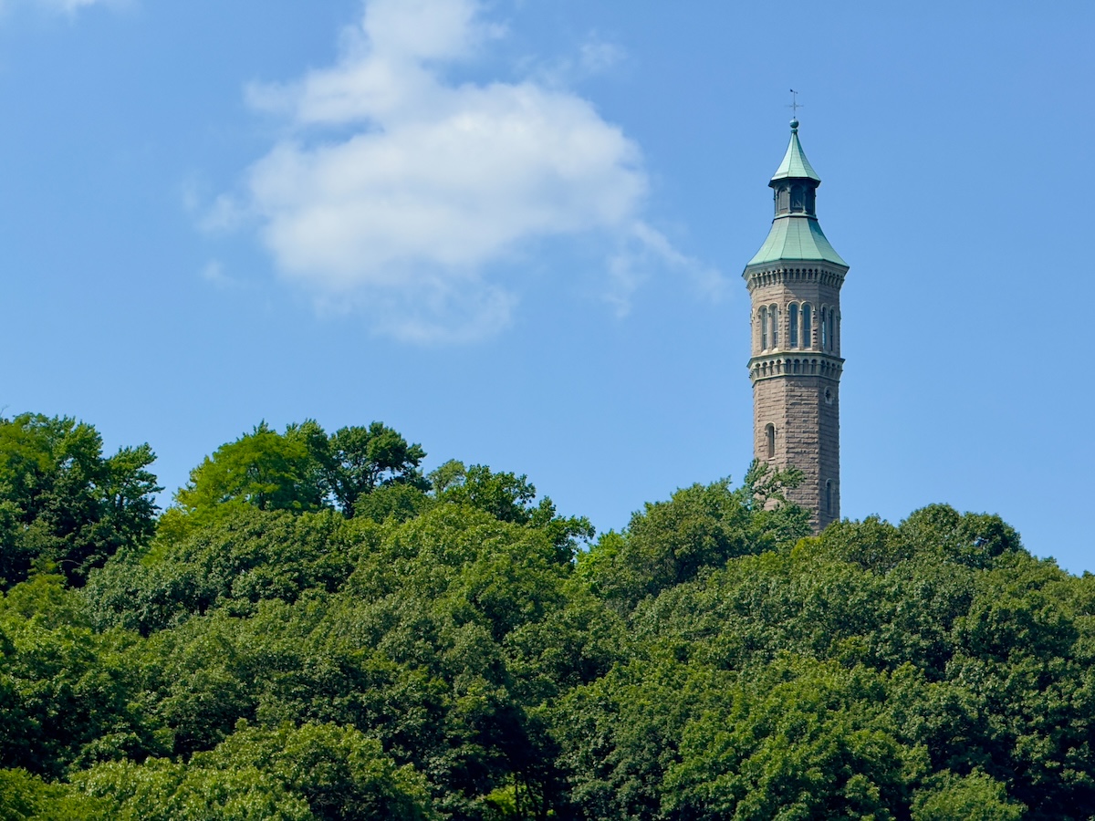
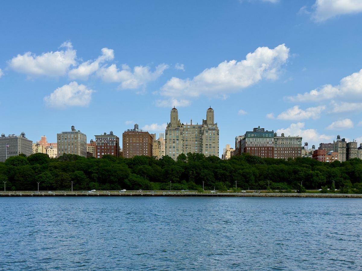
We turned south again from there and began retracing the Hudson shoreline back down toward Midtown. The run back down the Hudson revealed yet another version of Manhattan. Riverside Park formed a long green band along the shoreline, with the apartment buildings of the Upper West Side rising behind it like a tidy wall of brick and stone. Two monuments stood out on the bluff above the trees—Grant's Tomb, the largest mausoleum in North America, and the soaring tower of Riverside Church nearby. From the water, they looked almost like companions, keeping watch over the traffic sliding quietly past below.
By that point, the island had started to make sense. The neighborhoods we had walked through during our first week—SoHo, the Financial District, Midtown—no longer felt like isolated patches on a map. They had edges now. They belonged to a longer shape that wrapped around the water.
You can spend days wandering Manhattan and still see it as a series of disconnected streets and subway stops. But go all the way around it once, slowly, with the skyline sliding past on both sides, and something clicks into place. The island reveals itself not just as a collection of famous buildings but as a physical landscape with boundaries, currents, bridges, and history layered along its shoreline.
Which, as it turns out, is exactly what the Circle Line has been quietly helping people see since 1945. Sometimes the reason a thing becomes touristy is very simple. It works.


Write a comment